Research

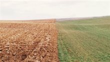
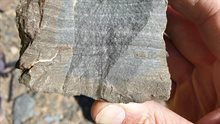
The subsurface of the Netherlands is an accumulation of soil layers, each with its own specific characteristics and genesis. By systematically collecting and analysing data, we’re building up knowledge of the subsurface from ground level and the seabed to approximately six kilometres deep. 

Wide range of areas

We use our knowledge to research and advise on topics such as sustainable energy, mineral extraction, water management, spatial planning, and infrastructure. The subsurface is increasingly being used for various purposes. We serve a wide range of policy areas and business sectors.

Close-up of the CO2 capturing installation Haagse Aardwarmte Leyweg

Energy transition

The subsurface plays a major role in the transition towards a sustainable energy system. The expertise of the Geological Survey of the Netherlands (GDN) is helping to make that transition possible.

Dutch landscape

Safe and liveable delta

The Netherlands is uniquely located in a river delta that is partly below sea level.

External facade with visible crack

Effects of mining

The above-ground consequences of mining deserve much attention. The production of natural gas and geothermal energy provide the Netherlands with a reliable energy system, in which the safety of inhabitants is paramount.

Groundwater field measurement

Digital subsurface

Of all the countries in the world, the most is known about the subsurface in the Netherlands. A treasure trove of data has been collected over more than a century in the Netherlands, most of which has now been digitised.

Atmospheric image of a piece of rock in which the stratification is clearly visible.

Expertise

Several areas of expertise make the Geological Survey of the Netherlands (GDN) the foremost institute for reliable information about the subsurface.

Overzichtsfoto Nederlands landschap als lappendeken.

Projects

We would like to give you an up-to-date overview of our projects.

Aerial photo of landscape with trees and water

Innovations

We would like to give you an up-to-date overview of our innovations.

Vrijstaand sfeerbeeld van oude mappen met papieren grondwaterkaarten van Nederland.

Publications

The researchers of the Geological Survey of the Netherlands (GDN) are continuously publishing their research results in various forms. You can find these publications via the TNO website and NLOG website, where technical publications and posters are stored in a RefShare database. We have selected a few of the many publications for you on this