
Hydraulic Conductivity Lab
Every day, we use an average of 120 litres of tap water per person. Half of this water is groundwater. Where that groundwater comes from and how fast it flows partly depends on the hydraulic conductivity of the subsurface. But why is one type of fine sand more permeable than another? At what proportion of fine particles (lutum and silt) does the sand’s hydraulic conductivity significantly decrease? And what influence do depositional environments have on hydraulic conductivity? Our hydraulic conductivity measurements are providing answers to these kinds of questions.
TopIntegraal an unique dataset
In order to link hydrological, lithological and geochemical properties of the subsurface, the Geological Survey of the Netherlands (GDN) has, since 2006, built a dataset with combined soil sample measurements. These soil samples originate from core drillings carried out in the context of TopIntegraal, GDN’s drilling and measuring program for the shallow subsurface of the Netherlands. The most important hydrological property we measure is a sample’s hydraulic conductivity when it is completely saturated with water (i.e. saturated hydraulic conductivity). Currently, the database contains measurement data of more than 5,000 samples.
After an extensive quality control, the measurement data of more than 4,600 samples from the TopIntegraal dataset have been published. In addition to permeabilities, this also concerns the metadata, lithological characteristics, lithostratigraphic unit, depositional environment (lithofacies code) and a quality label. The data and an accompanying report can be downloaded via Grondwatertools (only in Dutch).
Different measurement setups
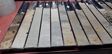
We measure the horizontal and vertical hydraulic conductivity of sandy samples in our hydraulic conductivity laboratory. To do so, we use laboratory permeameters that we have optimised using distance lasers. They allow us to accurately and at high frequency measure a rapidly declining water pressure difference above the sample.
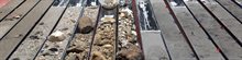
The hydraulic conductivity measurements of clay, loam, and peat samples are outsourced to an external geotechnical laboratory. After the measurements have been taken, we check whether there are any large shells, plant roots, wood residues, gravel, or other coarse materials in the sample. Too large particles in the sample can affect the reliability of our measurements.

Hydraulic conductivity data in our subsurface models
We link the huge quantity of hydraulic conductivity data to the lithological, stratigraphical, and sedimentological properties of the sampling boreholes from which the samples were taken. This is how we characterise the hydraulic conductivity of the various units in the Dutch subsurface. This characterisation then becomes the basis for adding hydraulic conductivity values to the subsurface models of TNO-GDN (GeoTOP and REGIS II).
In early 2021, the characterisation of the hydraulic conductivity of the shallow subsurface of the northern Netherlands was completed using our measurement data. Hydraulic conductivity statistics were determined per ‘lithostrat-litho class’ (the combination of geological unit and classified lithology used by the subsurface models, REGIS II and GeoTOP). The report preludes the next step of making the data set of the measured hydraulic conductivities publicly available. We expect to start this process in early 2022.
More information.
-

Jelle Buma
Functie:GeohydrologistSpecialisatie niet bekend-
E-mail:E-mail Jelle
-